


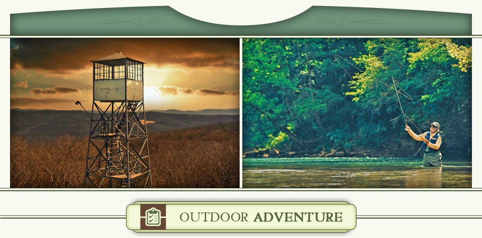
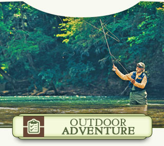
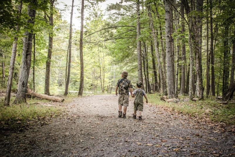
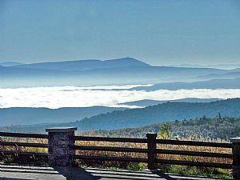
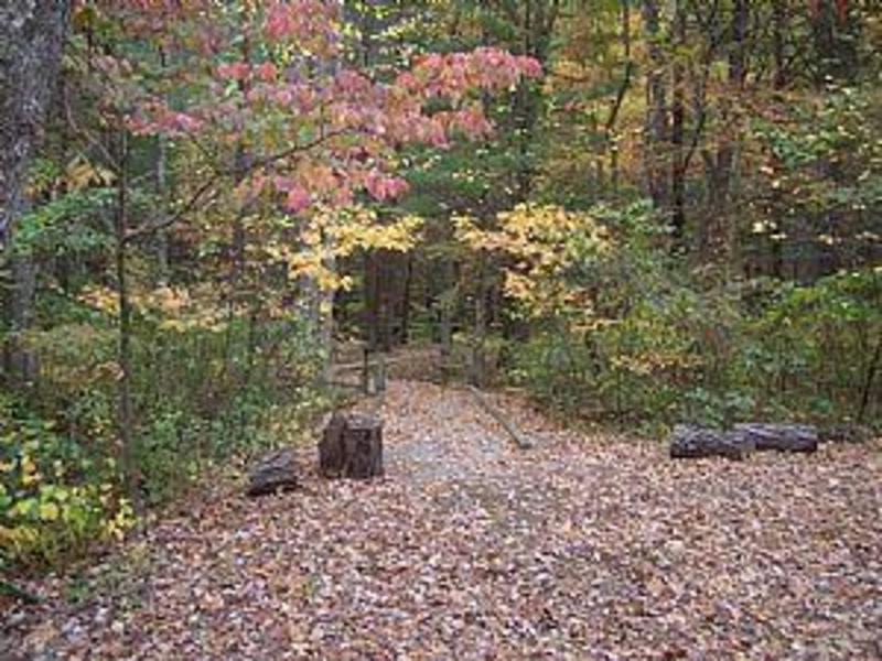
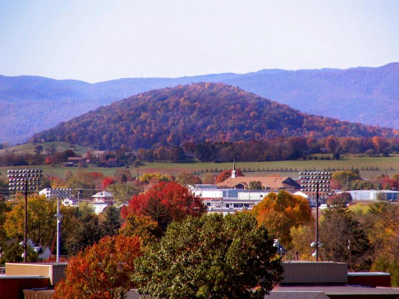
Virginia’s Western Highlands is home to wide open spaces with crisp mountain air and views that seem to go on forever.
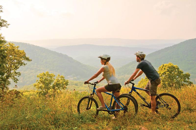
 With so much of our land protected by the United States Forest Service, this is the ideal place to experience the great outdoors. Enjoy a serene stroll through the woods to glimpse a Northern Mockingbird or hit the trail for an adrenaline-pumping ride on some of the best mountain biking trails in Virginia. Whichever outdoor adventure you choose, Virginia’s Western Highlands will create lasting memories.
Some of the region’s finest hiking, biking and horseback riding trails can be found in a new Trail Guide. Click here to request a free copy or view an interactive flip book that allows you to print as many pages and maps as you want.
- CovingtonAlleghany Highlands BluewayShow details
Locality:
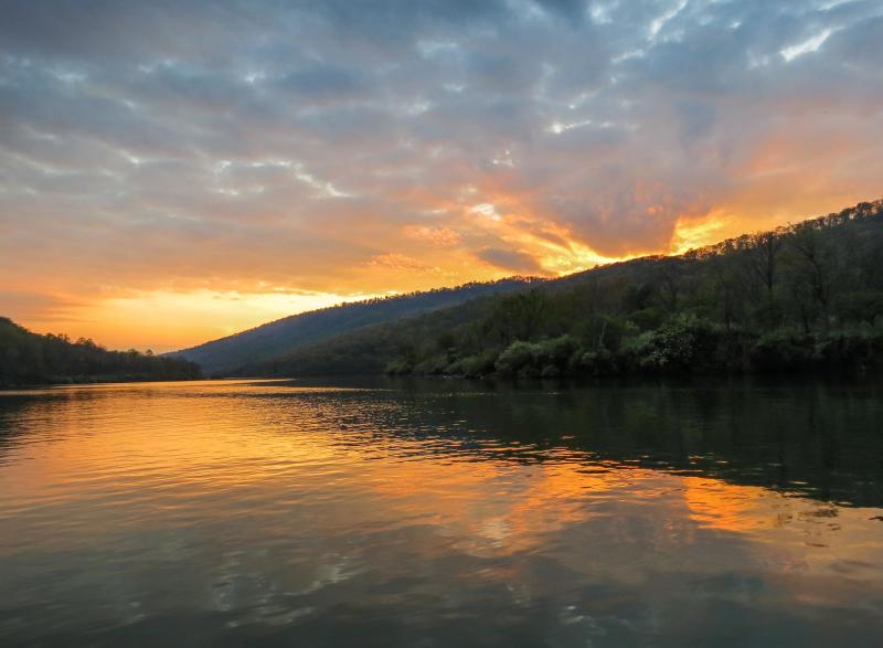
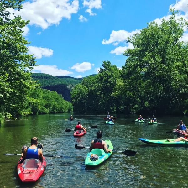
The Alleghany Highlands Blueway is comprised of two lakes and two scenic rivers that offer great paddling, fishing and boating. Each river and lake has its own unique personality and history, not to mention secret fishing spots. Take your time and spend a few days exploring the entire Alleghany Highlands Blueway. Approximately 30 miles of the wild and scenic Jackson River runs through the Alleghany Highlands and meets the Cowpasture River to form the headwaters of the James River. Several small streams feed into the Jackson River, including Dunlap Creek and Potts Creek, also offer excellent fishing. Approximately 10 miles of the Cowpasture River flows through the eastern portion of the Alleghany Highlands. Paddling on the Cowpasture is mostly moving water with a few easy straight forward rapids with great views of the surrounding mountains. Douthat State Park is not just one of Virginia's oldest state parks, it's one of its finest. Its contribution to the Alleghany Highlands Blueway is Douthat Lake, a 50-acre lake with swimming, boating and seasonal trout fishing. Lake Moomaw is the northern most portion of the Alleghany Highlands Blueway. The lake has 43 miles of undeveloped, wooded shoreline just perfect for exploring by canoe or kayak yet large enough for sailing and motorboats.
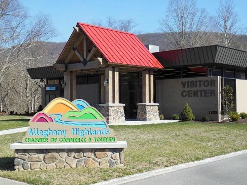
Alleghany Highlands Chamber of Commerce & Tourism
110 Mall
Covington, VA 24426Telephone:
540-962-2178
- CovingtonAlleghany Highlands Chamber of Commerce and TourismShow details
Locality:
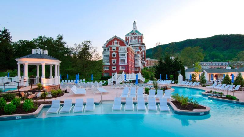
Virginia’s Western Highlands is located on the western edge of the famous Shenandoah Valley along the border with West Virginia. You’ll find everything that Virginia is famous for – history, beauty, hospitality – plus a few surprises found only in the Western Highlands. Craig County is the southern gateway to Virginia’s Western Highlands. More than 112,000 acres of National Forest give visitors to Craig County an enormous playground for fishing, hunting, birding, camping and hiking, including access to the famous Appalachian Trail. Step back in time as you stroll through historic New Castle and the one-of-a-kind town of Paint Bank, VA. The Alleghany Highlands is home to two pedestrian friendly downtowns and one of the oldest covered bridges in the United States. The downtowns of Covington and Clifton Forge offer locally-owned shopping and dining opportunities as well as historic sites like the C&O Depot, a meticulously restored passenger rail station and the C&O Railway Heritage Center which tells the story of the railroad and its vital role in the community. The Alleghany Highlands is perhaps best known for its outdoor recreation, including paddling, fishing, hiking and some of the best mountain biking in Virginia. Bath County is a magical four-season destination that has been welcoming guests for more than 250 years. The county is known for its unspoiled mountain views and impeccable hospitality, which includes award-winning B&B Inns and the world-class Omni Homestead Resort and Spa. In addition to an endless number of outdoor recreation options, visitors to Bath County can enjoy great dining, live music at Garth Newel Music Center, quaint shops and a local winery, cidery and craft brewery. In 2022, the historic Warm Springs Pools re-opened after a meticulous historically accurate restoration. Enjoy a day of golf, shopping or hiking, then take a rejuvenating soak in the waters of the natural mineral springs. Highland County is the northern gateway to Virginia’s Western Highlands. Home to the headwaters of the James and Potomac rivers, it is the least populous county in Virginia, and one of the least east of the Mississippi River. Its high average elevation is key to the success of the local maple syrup industry, which culminates each year in its longstanding Highland County Maple Festival. Known for its breathtaking beauty and rural charm, Highland is characterized by unspoiled forests, pristine waterways and high mountain pastures. Due to the abundance of clean, cold spring water, trout can be caught year-round in the county’s streams, and hunting for whitetail deer, black bear, and wild turkeys is a favorite activity on private land, national forests, and DWR’s Highland Wildlife Management Area. Beyond the natural wonders, Highland County holds a tight-knit community made up of a mix of native farm families and new residents drawn to the high quality of life. Several annual events, like the Mountain Mama Road Bike Challenge, Highland County Fair, and Hands & Harvest Festival provide family fun in all seasons. Overall, Highland County is perfect for those seeking solitude and a refreshing sense of freedom. Make yourself a part of our unique mountain culture!
110 Mall Road
Covington, VA 24426 - CovingtonAlleghany Highlands TrailsShow details
Locality:
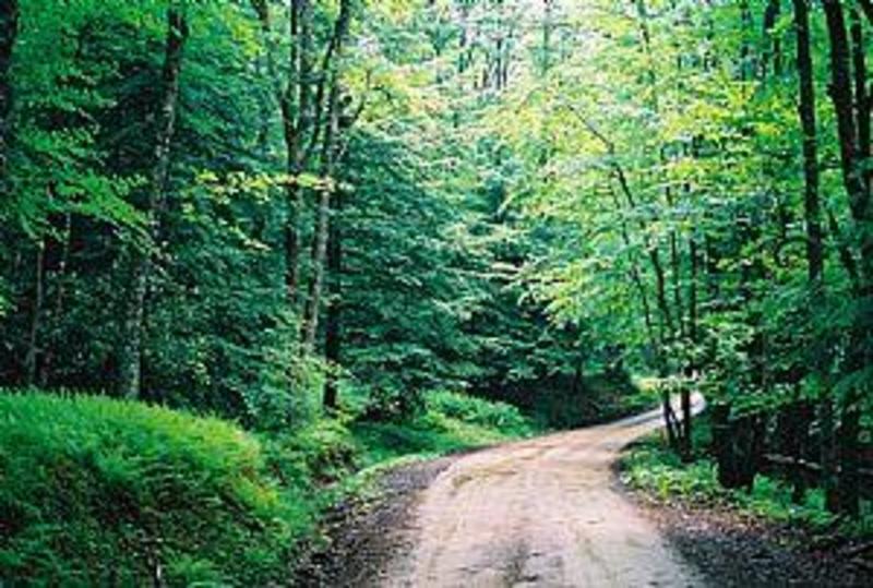
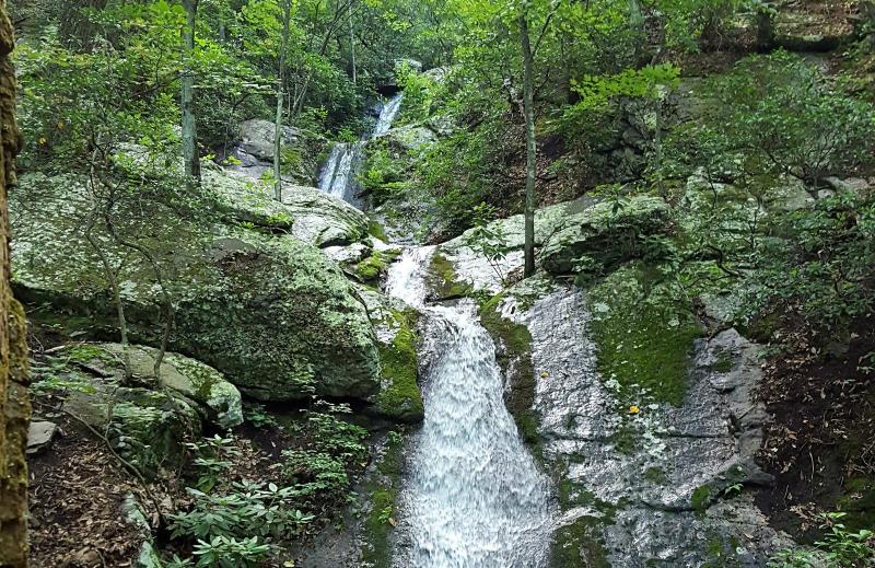
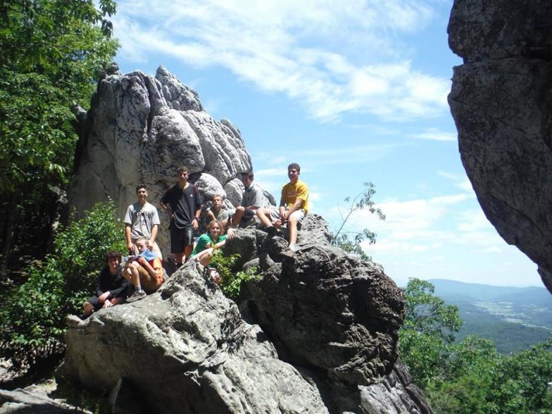
The scenic Allegheny Mountains of Virginia offer spectacular views, pristine wilderness and miles and miles of peaceful trails to explore. If you're ready for some hiking on peaceful wooded trails with mountain views, you'll find plenty of options in the Alleghany Highlands. If you prefer to explore the mountains on two wheels, our region is famous for having some of the best mountain biking trails in Virginia. If you enjoy trial riding on horseback, it's time to saddle up. Some trails will challenge the finest hikers, cyclists and riders, while others offer a relaxing walk in the woods for people of all ages and ability. Over 100 miles of trails are waiting to be explored.
Alleghany Highlands Chamber of Commerce & Tourism
110 Mall Road
Covington, VA 24426Telephone:
540-962-2178
- CovingtonAlleghany OutdoorsShow details
Locality:
Alleghany Outdoors is an outfitter company specializing in running river trips on the upper Jackson River and the Jackson River Scenic Trail below Lake Moomaw and Covington, Va. We rent kayaks, rafts, tubes, and mountain bikes for a variety of trip lengths and formats. We also operate a shuttle service to move customers upstream to launch areas. All of our trips are unguided. We are the contracted concessionaire outfitter of Alleghany County parks and recreation department to provide both river paddling and bike trail experiences for locals and tourists visiting the Jackson River scenic valley.
1903 Dressler Drive
Covington, VA 24426Telephone:
540-969-1800
Website:
http://alleghanyoutdoors.com - Hot SpringsAllegheny Springs at The Omni HomesteadShow details
Locality:
Our two-acre water park, Allegheny Springs, is fed by the waters from our natural springs. Experience the exhilarating thrills of our two 100-foot water slides* or enjoy a leisurely ride along our 400-foot lazy river. Kids love the water play zone and sandy beach, while the large family pool is ideal for everyone. A cozy whirlpool provides an intimate haven adjacent to the family pool. In winter, slip on a pair of skates and enjoy our ice skating rink.NOTE: Allegheny Springs is open to resort guests and members only. The whirlpool, lazy river and water slides are currently closed due to the phase 3 guidelines currently in place.
7696 Sam Snead Highway
Hot Springs, VA 24445Telephone:
800-838-1766
- CovingtonAllegheny TrailheadShow details
Locality:
Twelve miles of the Allegheny Trail pass through the James River Ranger District. The Allegheny Trailhead provides an excellent access point for hikers headed for the Laurel Run Trailhead, 15 miles to the north on the Monongahela National Forest. This long distance trail crosses and follows the Eastern Continental Divide in the rugged Allegheny Mountains of West Virginia and Virginia. When complete, it will extend 330 miles from Preston County West Virginia, near the Pennsylvania border, to the Appalachian Trail in Monroe County, West Virginia. The Alleghany Trailhead can be reached by exiting I-64 at Jerry's Run (Exit 1).
SR- 198/ Jerrys Run Trail
Covington, VA 24426Telephone:
540-962-2178
- MillboroAppalachian Waters Scenic BywayShow details

Locality:
Enjoy the fresh air, rustic splendor, and charm of the Allegany Highlands on the Appalachian Waters Scenic Byway.Start your drive in Warm Springs, the site of some of the rarest geological formations on Earth and home to the oldest original spa structure in America, Jefferson Pools. Just like an early settler, you can take a refreshing soak in these legendary mineral springs. After your bath, consider a delicious deli lunch at Milk House Market before continuing south to Hot Springs.Hot Springs is well known for its charming Main Street shops and famous Omni Homestead Resort. Featuring three championship golf courses, horseback riding, hiking, fishing, tennis, swimming, skeet and trap shooting, skiing, snowboarding, ice skating, and even falconry, this luxurious retreat is full of adventure and fun.Hop back onto the Byway and you’re back to the dense forest. If you like treasure hunts, be sure to check out the Appalachian Byway Geocache Challenge. Using a combination of online clues and GPS coordinates, locate “caches” hidden in interesting places. This challenge is a fantastic way for families to explore a new area together, and it’s free.This drive has a lot to see and do, so, if you have time, perhaps rent a cabin and spend a weekend exploring all the great adventures that the Appalachian Waters Scenic byway has to offer.
Rt 39 and Rt 42
Millboro, VA 24460Telephone:
804-545-5550
- New CastleAudie Murphy MonumentShow details
Locality:
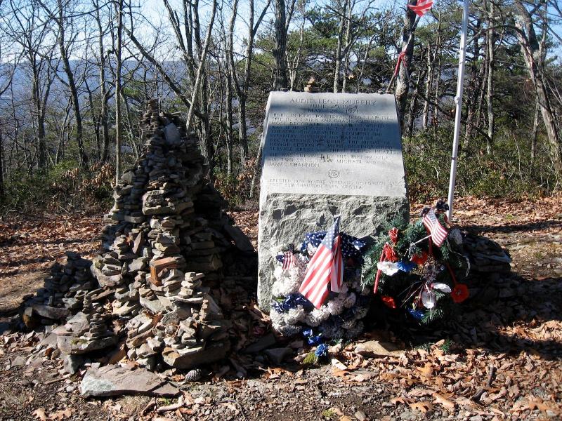
On May 28, 1971, Audie Murphy, the most decorated US soldier in World War II, died in an airplane crash on the slopes of Brush Mountain, near New Castle, VA. Three years later, the Veterans of Foreign Wars placed a stone monument near the site of the crash. The monument may be approached in several ways. For those wanting only a short walk, you may drive up Brush Mountain, but be prepared for a winding, graveled road. The road ends at the parking lot and from there it is an easy 1/2 mile hike to the monument. After viewing the monument, take the short trail to the rocky overlook to get beautiful views of the Craig Creek Valley.
Appalachian Trail
New Castle, VA 24127Telephone:
540-552-4641
Website:
http://www.fs.fed.us/r8/gwj/easterndivide/recreation/hiking/audie_trail.shtml - New CastleBarbours Creek Wilderness AreaShow details
Locality:
The Barbours Creek Wilderness area covers the southeastern slope of Potts Mountain in northern Craig County. You'll have a chance to find solitude here in a hardwood forest interspersed with yellow pine. Some hemlock and white pine grow in the drainages, including the major cross-Wilderness waterway, Lipes Branch, in which you may catch native brook trout. Barbours Creek itself is a popular trout-fishing spot. Much of the year the area is colored with flowering vegetation.Primitive camping is available at the Pines Campground where 17 large primitive sites under a forested canopy are available. From New Castle drive north on SR 615 for 2.5 miles. Turn left on SR 609 and continue for 2 miles. Turn left on SR 611 and go 3.4 miles. Go right on SR 617 and go 5.5 miles to the Lipes Trailhead or continue to the Pines Campground.
SR 617
New Castle, VA 24127Telephone:
540-552-4641
Website:
http://www.fs.fed.us/r8/gwj/recreation/wilderness/barbours_creek.shtml - Warm SpringsBath County Shooting RangeShow details
Locality:
The Bath County Shooting Range has 10 covered benches for shooting at 50 and 100 yards. The range provides an excellent place to zero- in your firearms. The range is located off SR 609 in Bath County approximately 5 miles east of Warm Springs. From Warm Springs take SR 39 east to SR 609. Turn left onto SR 609. The range entrance is on the right approximately 1.25 miles from the junction of SR 39 and SR 609.
SR 609
Warm Springs, VA 24484Telephone:
540-839-2521
Website:
http://bit.ly/l5dWil - New CastleBig Pine Trout FarmShow details
Locality:
Bubbling mountain stream seeks talented sportsmen for trophy-sized trout. Abundant catching opportunities await those who can outsmart the big ones. At Big Pine, we guarantee stocking placement for every angler. So bring your skill and limit out with 5 of these big Rainbows, Browns or Brookies, and carry home the catch for supper; or stay in our Upscale Contemporary Farmhouse.Big Pine is quietly located about 1 mile outside of historic New Castle just 20 miles North on Hwy 311 from I-81 and Roanoke. Your host is James Chewning at 877-277-TROUT or 540-864-5555 or contact us at BigPineTroutFarm@gmail.com. RESERVATIONS ONLY.GROUPS PREFERRED.www.bigpinetroutfarm.com
156 Meadow Brook Lane
New Castle, VA 24127Telephone:
540-864-5555
Website:
http://bigpinetroutfarm.com/ - Warm SpringsBlowing Springs Recreation AreaShow details
Locality:
Visitors to Blowing Springs Campground will be amazed by the phenomenon for which this site is named. A unique geological feature creates a duct that blows air out of the rocks at a constant 58 degrees, which may feel warm or cool depending on the season.Located just off of Virginia Highway 39, this area offers a variety of camping situations. The lower portion of the campground is a mostly open grassy field with plenty of room to spread out. The upper area is small tent sites in a wooded setting.Back Creek, which runs along one side of the campground, offers good fishing and plenty of swimming holes to cool down in on hot summer days. The campground has vault toilets and a hand pump for water. There is also a dump station for recreational vehicles.
SR 39
Warm Springs, VA 24484Telephone:
540-839-2521
Website:
http://www.fs.usda.gov/recarea/gwj/recreation/camping-cabins/recarea/?recid=73595&actid=29 - Warm SpringsBolar Flat MarinaShow details
Locality:
The Bolar Flat Marina boat launch is open year-round, offering convenient access to the scenic waters of Lake Moomaw. Launch conditions may vary with seasonal water levels, but the ramp generally provides reliable entry for most of the year. Boaters can enjoy night fishing with proper lighting and vessels up to 26 feet in length are accommodated. The nearby Bolar Flat Marina store provides everything needed for a full day or weekend on the lake. Including fuel, ice, live bait, fishing tackle, essential supplies and free Wi-Fi. Visitors will also find paddle boat rentals, wet slip rentals, trailer parking and dry storage and battery charging services available on-site. Whether you’re setting out for a quiet morning on the water or an evening fishing under the stars, Bolar Flat Marina & Store offers a well-equipped and welcoming starting point for your Lake Moomaw adventure. A scenic picnic and pavilion area is available to rent for $85 per day, offering the perfect setting for family reunions, weddings, celebrations, and group gatherings. Nestled along the shores of Lake Moomaw, this inviting space comfortably accommodates groups of more than 50 guests and features picnic tables, grills, direct lake access, secluded parking, and private restroom facilities for added convenience. A small, secluded beach is also located nearby, providing a peaceful spot to relax by the water. Whether you’re hosting a special event or a casual outdoor gathering, the pavilion offers a serene, well-equipped setting surrounded by the natural beauty of Virginia’s Alleghany Highlands.
8446 Bolars Draft Road
Warm Springs, VA 24484Telephone:
(540) 734-0160
Email:
bolarflatmarina@gmail.comWebsite:
https://www.facebook.com/people/Bolar-Flat-Marina-Store-Lake-Moomaw/61578211105535/ - MillboroBubbling Springs Recreation AreaShow details
Locality:
Bubbling Springs Day Use Area is a perfect place to escape the summer's heat. Shaded sites are ideal for family picnicking and children enjoy sticking their feet in the cool bubbling springs on a hot summer's day.Directions: From Exit 29 on I 64: Go north on SR 42 about 15 miles to the junction with SR 39. Turn right (east) on SR 39 and go about 1 mile to SR 635 to Millboro. At Millboro, the road becomes SR 633. Follow this about three miles to Forest Road 129 on the right. Take FR 129 ½ mile to Bubbling Springs on the left.
Forest Service Road 129
Pads Creek road
Millboro, VA 24460Telephone:
540-839-2521
Website:
http://www.fs.usda.gov/recarea/gwj/recreation/hiking/recarea/?recid=73623&actid=70 - Blue GrassBuck Run and Locust Spring Run TrailsShow details
Locality:
Buck Run and Locust Spring Run Trails are located on the turn-of-the-century railroad tram grades used by the previous landowner to log virgin timber. The Buck Run Trail provides a view of beaver ponds, open glades and vegetation that you would expect to see in Canada. The Locust Spring Run Trail provides views of northern hardwoods and is an ideal trail for viewing deer and wild turkey. Waterways in the area contain native Brook Trout. Both trails are designated with blue blazes. Directions: From Monterey, VA, travel north on Rt. 220 for 7 miles, turning left/west onto Rt. 642. This turns right ½ mile after passing through Blue Grass, travel 13 miles. Turn onto Forest Rd. 106. Turn right onto Forest Road 60. Travel ½ mile and turn right onto Forest Rd. 142. Drive ½ mile to Locust Springs. The two trails form a loop.
Forest Road 142
Blue Grass, VA 24413Telephone:
540-468-2550
Website:
http://www.roanokeoutside.com/ckfinder/userfiles/files/Alleghany_trail_guide.pdf - McDowellBullpasture GorgeShow details
Locality:
Bullpasture is a large boulder strewn mountain stream that holds both warmwater and cold water fish. Go west of Staunton on Route 250 until you reach McDowell. You will cross the Bullpasture entering McDowell. The road divides immediately - bear left. Stay on the road about 10 miles until you hit the gorge - you'll know when you reach it - there are steep mountain sides on the right side of the road and a drop to the river on the left and more mountain walls on the far side. The river will start to show Stocked Virginia trout waters signs. From the other direction, wend your way from Route 39 towards Williamsville. The Bull is stocked here and the gorge begins just upstream. Accomodations are in Monterey just up the road from McDowell.
11499 Bullpasture River Rd
McDowell, VA 24458Telephone:
540-468-2550
Website:
http://www.highlandcounty.org/ - CovingtonCliff View Golf Club & InnShow details
Locality:
18 hole scenic public golf course along the Jackson River open daily for play.
410 Friels Drive
Covington, VA 24426Telephone:
(540) 962-2200
Email:
cliffviewgolfandinn@gmail.comWebsite:
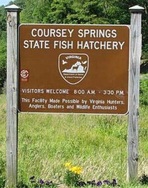
http://visitcliffview.com - MillboroCoursey Springs State Fish HatcheryShow details
Locality:
Coursey Springs is one of nine fish hatcheries operated by the Department of Game and Inland Fisheries. Originally constructed in the 1960's this new state of the art facility draws water from the 3rd largest spring in the State of Virginia and produces about 500,000 catchable size trout (or 350,000 pounds). Coursey Springs is strictly a grow-out facility; no trout are spawned or hatched here. It receives fingerlings from the Paint Bank Fish Culture Station in Craig County, VA and grows them to advanced fingerling or catchable size. Although the hatchery has no formal visitors center, the public is welcome to receive a free guided tour, 365 days a year.
300 Hatchery Lane
Millboro, VA 24460Telephone:
540-925-2343
Website:
http://www.dgif.state.va.us - New CastleCraig Creek Recreation AreaShow details
Locality:
Craig Creek Recreation Area, located in Botetourt County, VA 11 miles east of New Castle, is a great place to take the family on hot summer days to enjoy the outdoors. Families and groups can camp, picnic, fish, wade, and hike. There is also space for camping with horses. The Recreation Area encompasses over 130 acres of pasture and woodland on a peninsula formed by Craig Creek.
east of Oriskany, VA; off of Old Rail Rd/ Rt. 817 Coordinates: 37.613556, -79.960304
New Castle, VA 24127Telephone:
540-552-4641
Website:
http://www.fs.fed.us/r8/gwj/newcastle/recreation/day_use_areas/craig_creek.shtml - Warm SpringsDan Ingalls OverlookShow details
Locality:
Dan Ingalls Overlook is situated on the spine of Warm Springs Mountain on Route 39. Dan Ingalls Overlook offers a stunning view to the East as well as access to the Warm Springs Mountain Preserve's Dan Ingalls Overlook Trail. The Overlook provides an interpretive display explaining the historical significance of the location. Benches are provided.
Warm Springs Mountain
Route 39
Warm Springs, VA 24484Telephone:
0
- MillboroDouthat State ParkShow details
Locality:
A traditional family park for more than 70 years, Douthat is listed on the National Register of Historic Places because its design influenced the development of parks nationwide. Amid some of Virginia’s most breathtaking mountain scenery, visitors enjoy miles of stream fishing, a 50-acre lake stocked with trout, a sandy swimming beach with a snack bar, boat and bicycle rentals, a gift shop and a camp store, and cabins. Guests enjoy more than 40 miles of hiking and mountain-biking trails, an amphitheater, playgrounds, picnic areas, tent and trailer camping, and nature and history programs. The park also features two completely furnished lodges that accommodate 15 and 18 guests each. It’s just 5 miles outside Clifton Forge. Exit 27 off Interstate 64 to State Route 629, then 7 miles north.
14239 Douthat State Park Road
Millboro, VA 24460Telephone:
(540) 862-8100
(800) 933-7275
Email:
douthat@dcr.virginia.gov - CovingtonDry Run TrailheadShow details
Locality:
The Dry Run Trail is a scenic 9-mile trail offering excellent vistas and wildlife viewing opportunities as it passes near Big Knob, the highest point in Allegheny County. The trail begins at the end of Cyprus Street in Covington. It extends up Dry Run Creek and Peter's Ridge, crosses FDR 125 and ends at its intersection with the Fore Mountain Trail. It can also be accessed from FDR 125.Directions:From Covington:W Riverside St Bear right onto Hickory StRoad name changes to E Hickory StTurn left onto N Greenbrier AveTurn right onto E Cypress St Bear right onto E Cypress StArrive at Dry Run Trailhead
E Cypress Street
Covington, VA 24426Telephone:
540-962-2214
Website:
http://www.fs.fed.us/r8/gwj/jamesriver/recreation/hiking/index.shtml - CovingtonEastern National Children's ForestShow details
Locality:
The Eastern National Children's Forest is a unique site offering an easy hike for children and others who want an outdoor experience without an arduous and challenging hike. In 1971 a wildfire burned 1,176 acres on Potts Mountain which is about 22 miles south of the City of Covington. In 1972, over 1,000 children converged on the site from surrounding states and planted pine trees on the site. Since the planting a diverse forest ecology has developed with species of various soft and hardwoods. A monument remains with the names of the participating children and a time capsule which is to be opened in the year 2072.
SR 18
Covington, VA 24426Telephone:
540-962-2214
- CovingtonEscatawba FarmsShow details
Locality:
Escatawba is the Native American word for “clear, running water.” That’s exactly what you’ll find here. And with it, some of the most spectacular fly-fishing in the world. Located in Alleghany County, Virginia, Escatawba Farms is home of Dunlap Creek, a freestone stream that runs in between wooded moutainsides and fenced pastures. For novice anglers and stillwater enthusiasts, Escatawba Farms boasts a one and a half-acre, spring-fed lake. Tucked back in the woods, back from the stream, holding dozens of big, cruising rainbows and brook trout, many of them citation size. To ensure a peaceful day we limit the number of rods on the stream for ideal angling.Guides and lessons are available.
6515 Dunlap Creek Rd.
Covington, VA 24426Telephone:
540-962-6487
Website:
http://www.escatawba.com - Clifton ForgeEvan's Tract on the Cowpasture RiverShow details
Locality:
Evan's Tract provides access to Cowpasture River and its adjoining fields and woodland. The hay fields along the river attract a variety of birds and butterflies, excellent site for water activites and wildlife observation.DirectionsFrom Callie Furnace, return to Rt. 622 and turn right; travel south 0.5 miles to Rt. 633. Turn left and continue east on Rt. 633 for 2.4 miles to US 220. Cross US 220 and continue east on Rt. 633 for 2.5 miles. Evans Tract is on the left just after crossing the Cowpasture River.
SR 633
Clifton Forge, VA 24422Telephone:
540-962-2214
Website:
http://www.dgif.virginia.gov/vbwt/site.asp?trail=2&loop=MAH&site=MAH11 - CovingtonFalling SpringShow details
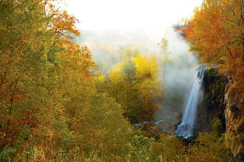
Locality:
Falling Spring Falls is a breathtaking 80' waterfall that is one of the most visited and photographed spots in the Alleghany Highlands. The scenic waterfall is located on Route 220 in Alleghany County, just five miles north of Covington, Virginia. The property has had extensive renovations to the overlook and grounds, including a picnic area, so that visitors can more safely stop and enjoy the view. Thomas Jefferson described the Falling Spring Falls as a "remarkable cascade...falling over a rock about 200 feet to the valley below." One of the largest falls in Virginia, it cascades from an overhanging ledge, and is easily visible from the roadway. Please note, venturing from the overlook to explore the Falls is dangerous and illegal. The area beyond the fence is posted as no trespassing and violators are subject to fine.
Hot Springs Rd
Covington, VA 24426Telephone:
540-962-2178
- New CastleFenwick Mines Recreation AreaShow details
Locality:
Formerly an iron mining site in the 19th Century, the Fenwick Mines Recreation Area holds importance both as a historic area and as a wildlife observation area. The Fenwick Mines Recreational Area is a nice spot to have a picnic and to walk one of the areas unique hiking trails. The trails are wheelchair accessible and allow hikers to view a variety of wildlife. The site has a large picnic shelter, grills, toilets, and a fishing pond.
State Route 685
New Castle, VA 24127Telephone:
540-552-4641
Website:
http://www.fs.fed.us/r8/gwj/easterndivide/recreation/day_use_areas/fenwick-mines.shtml - CovingtonFore Mountain TrailShow details
Locality:
Fore Mountain Trail is a scenic 13 mile hikin and mountain biking trail in northern Alleghany County. Leaving Covington it rises to the top of Fore Mountain in a series of switchbacks. The hike to the ridge top is steep but during leaf off it offers some great views of the Covington Area. Once at the top, the trail runs the length of Fore Mountain. It switches from one side of the ridge to the other several times on the journey east. There are many clearings and ponds along the trail that offer good views and peaceful resting spots. At the end of the Fore Mountain Trail, the path continues on as Middle Mountain Trail to Douthat Lake in Douthat State Park, extending the 13 mile hike to a potential 18 mile hike if the hiker chooses the option of hiking to the State park.
Off US Route 60 East of Covington
Covington, VA 24426Telephone:
540-962-2214
- Warm SpringsGathright Dam and Bolar Recreation ComplexShow details
Locality:
The Bolar Mountain and Bolar Flat Recreation areas on the northwest shore of Lake Moomaw are among the most popular developed recreation areas in the George Washington National Forest. Approved by Congress in 1947, the Gathright Dam and most of the recreation facilities were constructed by the Army Corps of Engineers between 1965 and 1979. Gathright Dam and Lake Moomaw provide flood and water quality control along the Jackson and James Rivers in western Virginia. Much of the shoreline of Lake Moomaw is adjacent to the 13 acres T.M. Gathright Wildlife Management Area managed by VDGIF and is devoted to the management of wildlife. There are about 10 miles of maintained trails in the Bolar Recreation Area. Trails are for hiking only. The Grouse Point Overlook and the Island Overlook provide panoramic views of Lake Moomaw.
756 Twin Ridge Dr.
Warm Springs, VA 24484Telephone:
540-279-4144
Website:
http://www.fs.usda.gov/recarea/gwj/recarea/?recid=73609 - Hot SpringsGathright Wildlife Management AreaShow details
Locality:
Located in Bath County and divided by Lake Moomaw, the two tracts of the Gathright Wildlife Management Area contains 13,428 acres, encompassing three major mountains, the Allegheny, Bolar, and Coles Mountains. Elevations range from 1,400 to 3,600 feet. Numerous streams flow eastward from the steep side of Allegheny Mountain and have created a series of secondary ridges and hollows that terminate at Mill Creek. The US Forest Service manages several campgrounds nearby. There is also a shooting range in the WMA for sighting in rifles.Excellent fishing is also available in the WMA on the shores of Lake Moomaw.Please visit the VA Department of Game and Inland Fisheries site linked below for a map, directions, and applicable rules and regulations.
SR 600
Hot Springs, VA 24445Telephone:
540-248-9360
- Hot SpringsGeorge Washington National Forest - Warm Springs Ranger DistrictShow details
Locality:
Come out and enjoy the great outdoors on the beautiful Warm Springs Ranger District. Some of the best trout streams in the state run through this area of the forest and some of these streams feed into Lake Moomaw.Lake Moomaw offers boating, water skiing and swimming, in addition to fishing. Several nearby developed campgrounds offer a good place to stay while you enjoy the outdoors. You will discover that the abundance of roads open during hunting season, and isolated places to hike into, together with plentiful game make the district a great place to hunt. There are many good places for horseback riding and hiking on over 120 miles of trails, or you can travel around the back roads by automobile and enjoy the beautiful scenery.
422 Forestry Road
Hot Springs, VA 24445Telephone:
540-839-2521
- Clifton ForgeGreen Pastures/Longdale Recreational AreaShow details
Locality:
In the 1930's the Clifton Forge Chapter of the NAACP requested that the Forest Service construct a recreation area for use by the African Americans in the area. During this era, segregation in America was the norm, and African Americans were prevented from using forest facilities. The plans were approved in 1936 and construction of the recreation area began in 1938. On June 15, 1940, the area was dedicated as "Green Pastures Recreation Area" and opened to the public. Green Pastures was built by the Dolly Ann Civilian Conservation Corp Camp F24. The bath house, picnic shelter, and the two restroom facilities are all original buildings. The dam is also an original structure that was built by hand. On April 23, 1963, the name was changed to Longdale matching the community name. The Longdale community is a Virginia Historic District. L
U. S. Forest Service District Office
201 Green Pasture Trail
Clifton Forge, VA 24422Telephone:
540-962-2214
Website:
http://www.fs.usda.gov/recarea/gwj/recarea/?recid=73821 - McDowellHayfields State ParkShow details
Locality:
Hayfields State Park is situated in Highland County, nestled between Bullpasture and Jack Mountains, with an elevation ranging from 1,800 to 2,400 feet. The park features a diverse landscape that includes heavily wooded mountains, open valley pastures and several historic structures, including a farmhouse from the 1800s. The Bullpasture River flows through the property for about a mile, providing a habitat for various threatened and endangered species. The park offers 4 miles of easy-to-moderate hiking and biking trails, along with fishing access along the Bullpasture River. While the park is open daily, its hours are currently limited. Visitors are encouraged to call 540-396-4489 to confirm availability before their arrival.
524 Hayfields Lane
McDowell, VA 24458Telephone:
(540) 396-4489
- Warm SpringsHidden Valley Dispersed Recreation AreaShow details

Locality:
Situated in Bath's remote Hidden Valley area of the George Washington National Forest, this area is rich in both history and natural beauty. The 6.5 miles of the Jackson River offer excellent fishing for stocked and native trout. There are over 20 miles of trails offering excellent hiking, scenic views and mountain biking. Campground offers 30 sites. Poor Farm is located at the north end of Hidden Valley and named for the home operated lasy century by the Commonwealth of Virginia for needy people. Poor Farm is one of the most popular fishing, hunting and dispersed camping spots in the District. Good hiking trails connect Poor Farm to Hidden Valley.
https://w3w.co/atmospheric.stays.tracking
Warm Springs, VA 24484Telephone:
540-839-2521
- MontereyHighland CountyShow details
Locality:
Located at the western edge of the Shenandoah Valley region of Virginia in the Alleghany Mountains, Highland County enjoys one of the highest mean elevations of any county east of the Mississippi River. Called "Virginia's Little Switzerland" or "Virginia's Sweet Spot" with roughly 2300 residents, it is also the least populous county in the Commonwealth. Monterey, the county seat, is located 45 miles west of the intersection of Interstates 81 and 64 in Staunton. The annual Highland County Maple Festival draws over 25,000 visitors annually and is designated a "Local Legacy" by the Library of Congress. Highland County is home to Virginia's first Barn Quilt Trail, the Mountain Mama Road Bike Challenge, Highland County Fair, Hands & Harvest Festival, Wintertide, McDowell Battlefield, and more. The county is 416 square miles of spectacular mountain terrain.
Highland County Chamber of Commerce
61 Highland Center Drive
Monterey, VA 24465Telephone:
(540) 468-2550
Email:
director@highlandcounty.orgWebsite:
http://www.highlandcounty.org - McDowellHighland Wildlife Management AreaShow details
Locality:
14,007 acres located in Virginia's Western Highlands in the Alleghany Mountains where you can enjoy a day of hiking or pitch a tent at one of the primitive campsites. Picnic areas are also available. Bring your field glasses and try spotting some of the local wildlife: bear, deer, turkey, squirrel, or grouse.
Virginia Game Commission
Rt. 250
McDowell, VA 24465Telephone:
540-468-2149
- Clifton ForgeHighlands Scenic BywayShow details
Locality:
The Highlands Scenic Drive is a 19 mile loop between Clifton Forge in Alleghany County and Interstate 64 at Lexington.The scenic drive is a must-see experience for all visiting Virginia's Western Highlands and makes the outdoors and nature accessible even to those who would rather not hike into a wilderness area.Take Exit 43 off I-64 westbound, go short distance on SR 780, turn left on Forest Road 447 to begin the 19 mile loop tour.
Interstate 64 West, Exit 43
Clifton Forge, VA 24422Telephone:
540-962-2214
- CovingtonHumpback BridgeShow details
Locality:
Humpback Bridge is the only covered, humpback bridge remaining in the United States. It's also a cherished landmark, now listed on the National Register of Historic Places, where residents and visitors alike gather for picnics, photos or simply to admire her beauty and craftsmanship.The bridge was constructed in 1857, and the design of the bridge, to be covered and arched, was to increase its longevity and keep the midpoint above flood waters. This nearly 110 foot structure was built with a broad axe and put together with hand hewed locust pins. The bridge was used for vehicular traffic on Route 60 (Midland Trail) until 1929. In 1953, The Covington Business and Professional Woman's Club, the Virginia Department of Transportation, and the area residents restored the bridge. Three eras of transportation history can be seen at this site: the old road crossing Humpback Bridge, the new state highway bridge on Route 60 (Midland Trail) and the CSX railroad bridge.Fans of covered bridges come from all over the world to admire the historic Humpback Bridge. It has been lovingly preserved and is now part of a five-acre wayside park. It's uniquely Alleghany.
Midland Trail
Covington, VA 24426Telephone:
540-962-2178
- CovingtonIndian Draft - Jackson RiverShow details
Locality:
Indian Draft is a river access point along the Jackson and a potential put out point if floating down from Gathright Dam. The rapids at Indian Draft, although not large enough to cause any real danger, add a little excitement to the float down from Gathright Dam. Travelers pass through a corridor flanked by sycamores on both sides and a ceiling of clear blue sky. Each turn provides the observer with a surprise maybe a white-tailed doe and her spotted fawn or perhaps a family of wood ducks with their fluffy young. On closer inspection, the banks hold numerous varieties of wildflower. From I-64, take Exit 16 for US 220 N, turn left on US 220/US60, and make another left to remain on US 220 N for 5.2 miles. Make a slight left at Jackson River Road SR 687. Continue on 687 to Indian Draft.
Jackson River Road
Covington, VA 24426Telephone:
540-962-2214
Website:
http://www.dgif.virginia.gov/fishing/waterbodies/display.asp?id=153 - CovingtonJackson RiverShow details
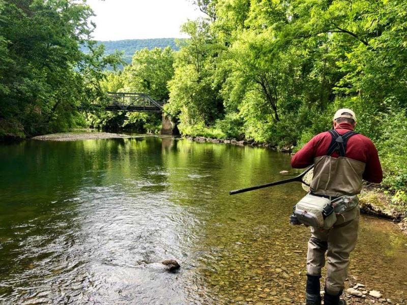
Locality:
Headwaters in neighboring Highland County; prime fishing; stocked river; access points for public fishing; most popular just below Gathright Dam in the cold, high oxygen water and in Bath County at Hidden Valley; easy access; camping nearby; fly fisherman's paradise in the portion surrounded by the George Washington/Jefferson National Forest
Jackson River Rd.
Covington, VA 24426Telephone:
540-962-2214
Website:
http://www.dgif.virginia.gov/fishing/waterbodies/display.asp?id=153 - CovingtonJackson River Scenic TrailShow details
Locality:
The Jackson River Scenic Trail follows its namesake river. The trail follows an old railroad bed of the Chesapeake and Ohio Railway (Hot Springs Branch) and passes through small communities, cultivated fields, and small patches of woodland along the way. It's common to see wildlife from the trail (birds, turtles, raccoons, rabbits, ground hogs, and deer).With a trailhead located just minutes from downtown Covington, the Jackson River Scenic Trail has a surface of finely crushed gravel and is well-suited for family rides and hikes. There are four trailheads along the 14 miles, with a proposed 5th for future expansion.The trail hosts the Alleghany Highlands Chamber of Commerce & Tourism Annual Marathon.
1903 Dressler Drive
Covington, VA 24426Telephone:
540-962-2178
- CovingtonJackson River Sports ComplexShow details
Locality:
On Veterans Day 1996, the Vietnam Veterans Memorial Fund (VVMF) unveiled a replica of the Vietnam Veterans Memorial in Washington, D.C., designed to travel to communities throughout the United States. Since its dedication, The Wall That Heals has been displayed at nearly 700 communities throughout the nation, spreading the Memorial’s healing legacy to millions. Bringing The Wall home to communities throughout our country allows the souls enshrined on the Memorial to exist once more among family and friends in the peace and comfort of familiar surroundings. The traveling exhibit provides thousands of veterans who have been unable to cope with the prospect of facing The Wall to find the strength and courage to do so within their own communities, thus allowing the healing process to begin. The main components of The Wall That Heals are The Wall replica and the mobile Education Center. The Wall That Heals—a traveling, three-quarter scale replica of the Vietnam Veterans Memorial in Washington, D.C., that tours the country—will be on display in the City of Covington from October 3, 2024 through October 6, 2024 at the Jackson River Sports Complex. Click here to view the event schedule.
870 Edgemont Drive
Covington, VA 24426Telephone:
540-965-6360
Website:
http://www.covington.va.us/index.php/about/parks-and-recreation/city-parks#jacksonrivercomplex - Iron GateJames River - Allegheny CountyShow details
Locality:
Forming from the Cowpasture and Jackson Rivers with its headwaters in the town of Iron Gate in southern Alleghany County, the James River offers a wide diversity of fishing opportunities. Bass, catfish and sunfish are the main species and the river boasts many public boat landings for canoes or other small craft.
Fork Farm Road
Iron Gate, VA 24448Telephone:
540-962-2178
- CovingtonJohnson SpringsShow details
Locality:
Johnson Springs is a Jackson River Access Point. Johnson Springs provides access to a serene mirror calm stretch of the Jackson River. Massive sycamores stretch out over the river along the bank, hosting chickadee and titmouse flocks as they travel the river in search of food. Directions: North on US-220 Bear left onto Jackson River Rd Turn left onto Indian Draft Rd Bear right onto E Morris Hill Rd Turn right onto Natural Well Rd Arrive at Johnson Springs on the left (The last intersection is W Morris Hill RdIf you reach SR-687 / Jackson River Rd, you've gone too far)
Natural Well Road
Covington, VA 24426Telephone:
540-962-2214
Website:
http://www.dgif.virginia.gov/vbwt/site.asp?trail=2&loop=MAH&site=MAH02 - Warm SpringsLake MoomawShow details
Locality:
Lake Moomaw was named in memory of Benjamin Moomaw whose efforts succeeded in bringing the lake to the Allegheny Highlands. Lake Moomaw is among the most popular developed recreation areas in the George Washington National Forest and provide an endless array of activities including boating, fishing, hiking, biking and camping. Lake Moomaw is renowned for its excellent fishing yielding citation size brown and rainbow trout, as well as good bass, pan and crappie.
Route 600
756 Twin Ridge Drive
Warm Springs, VA 24484Telephone:
540-839-2521
- CovingtonLake Moomaw and Gathright DamShow details
Locality:
13,428 acre T. M. Gathright Wildlife Management Area; 2,530 acre lake; year round boating, water sports, fishing, camping, picnicking, hiking and hunting (in season); abundant wildlife includes bald eagles, white tail deer, turkeys, etc.; stocked lake; group picnic shelters; information center with observation deck; handicap fishing decks; sandy beachs with modern bathhouse adjacent; multiple ramps lighted docks. All National Forest land.Fishing:AlewifeTrout (brown, rainbow and brook)Black BassYellow PerchPanfishCatfishChain PickerelBlack CrappieRock BassSunfishBoat RampsFortney Branch (south end)Bolar Flats (north end)Coles Mountain (south end)CampingBolar Mountain (north end)McClintic Point (north end)Greenwood Point (midlake)Morris Hill (south end)Other Recreational SitesColes Point (south end) - beach, bathouse, boat launch, picnic
George Washington National Forest
6214 Fortney Branch Rd
Covington, VA 24426Telephone:
540-962-2214
Website:
http://www.dgif.virginia.gov/fishing/waterbodies/display.asp?id=88 - CovingtonLow Moor Shooting RangeShow details
Locality:
Located between Clifton Forge and Covington. Exit I-64 at Low Moor (Exit 21), go past entrance of the Alleghany Regional Hospital, go through railroad overpass, turn right onto Route 616 (Rich Patch Road) and follow approximately 1.6 miles. Turn left onto FDR 616 at the sign to the shooting range just past the Virginia Power Company sub-station on the left. Six rifle benches and 3 pistol benches are under roofed shelter. Features are: rifle range-stationary targets at 50 and 100 yards, and pistol range-stationary targets at 25 yards. Moving targets, such as clay pigeons are prohibited, as are glass bottles. Shooters must supply their own targets and are asked to keep the range clean of litter by taking away all target materials with them. Parking available for 5 vehicles. The range is open year round.
FDR 616
Covington, VA 24426Telephone:
540-962-2214
Website:
http://www.dgif.virginia.gov/hunting/shootingranges.asp - Warm SpringsMcClintic Point Group CampsiteShow details
Locality:
Group Campsites at McClintic Point Family and group camping areas can be reserved online at www.recreation.gov. Three group camping areas and 21 family campsites are available, complete with grills, fire pits and vault toilets. Group sites include a playing field and horseshoe pit. No electrical hookups are available. McClintic Point Family and Group Campgrounds are open year-round.
756 Twin Ridge Drive
Warm Springs, VA 24484Telephone:
540-839-2521
Website:
http://www.fs.usda.gov/recarea/gwj/recreation/camping-cabins/recarea/?recid=73829&actid=33 - MontereyMonterey CampgroundShow details
Locality:
Nestled within the Allegheny Mountains in Highland County, Virginia, Monterey Campground welcomes travelers arriving by car, bicycle, or motorcycle. Whether you’re coming off the Mid-Atlantic Back Roads Discovery Route by motorcycle or exploring Highland County’s picturesque mountain roads by bike or car, Monterey Campground offers safe and clean camping accommodations in a scenic setting. Bring your own tent, or book a bunk bed in our Clubhouse. The entire Clubhouse is available for rent exclusively if you’re planning a group getaway or a family vacation. Stay for one night or longer to enjoy pristine mountain air, peaceful views, wildflowers, birds, or other wildlife in our fields and woodlands. Our camping sites are also located within close proximity to the James River and Jackson River as well as some of the best motorcycle routes in Virginia. We will provide information about nearby restaurants, attractions, and the best roads to travel. We can even schedule guided motorcycle excursions for you and your party through Allegheny Motorcycle Tours — our on-site guide company! Highland County is, after all, one of the best places to ride a motorcycle. (Sorry, we cannot accommodate RVs at this time.)
5026 Jackson River Road
Monterey, VA 24465Telephone:
(540) 280-4782
Email:
dkauffman2002@yahoo.com - Paint BankPaint Bank Fish HatcheryShow details
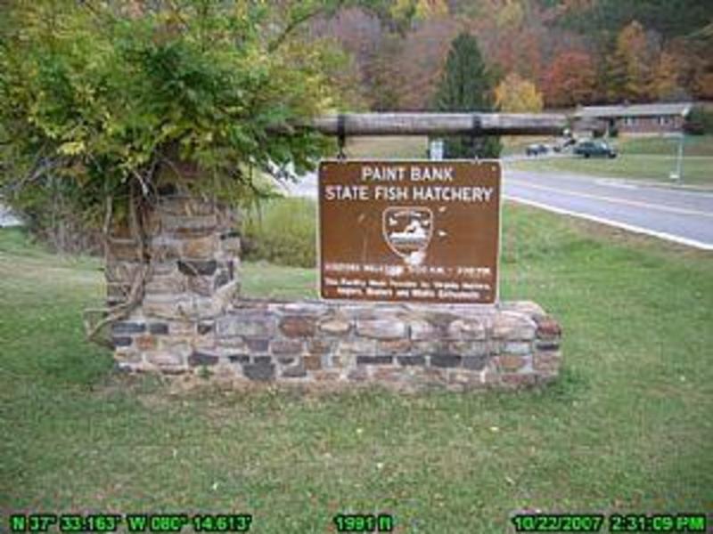
Locality:
This state fish hatchery, just south of Paint Bank, provides a unique look into the trout rearing and stocking process. Numerous concrete tanks hold up to 1.6 million trout in all stages of development, thus providing an easy viewing experience. Around the fish hatchery is a variety of wildlife. The creek that runs along the edge of the property should be checked for butterflies, birds and at dusk some white-tailed deer. There is a picnic area and plenty of parking.
Route 1 Box 12 (Off SR 311 south of Paint Bank)
Paint Bank, VA 24131Telephone:
540-897-5401
Website:
http://www.dgif.virginia.gov/vbwt/site.asp?trail=2&loop=MIO&site=MIO05 - CovingtonPetticoat Junction - Jackson RiverShow details
Locality:
Petticoat Junction is an access along the Jackson River for canoes/kayaks (one could put in at Gathright Dam and float down the Jackson to this point). Petticoat Junction is the last pull out before floating down into Covington. From I-64, take Exit 16 for US 220 N, turn left on US 220/US60, and make another left to remain on US 220 N for 5.2 miles. Make a slight left at Jackson River Road SR 687. Turn left on Mays Lane. Go 0.2 miles to the riverfront.This site is also on the Virginia Birdiing and Wildlife Trail. According to the Department of Game and Inland Fisheries, "These surroundings support anticipated birds such as indigo buntings and song sparrows. Along forest edges these birds can be heard singing from prominent points and popping out of denser patches of scrub and grass. The woods ring with the familiar calls of Carolina wren, northern cardinal and northern flicker, while the river hosts great blue and green herons, wood duck and belted kingfisher. Butterflies such as eastern tiger swallowtail and red-spotted purple float between cardinal flowers and black-eyed Susans. The glittering ebony jewelwing sticks to shady sections along the stream, often sharing their perch with eastern painted turtles."
Mays Lane
Covington, VA 24426Telephone:
540-962-2214
Website:
http://www.dgif.virginia.gov/vbwt/site.asp?trail=2&loop=MAH&site=MAH05 - Paint BankPotts Creek OutfittersShow details
Locality:
Potts Creek Outfitters provides year round fly fishing for rainbow and brown trout along our private sections of Potts Creek. Certified casting instructors are available for beginners and experts. Ask about our smallmouth bass float trips on the New River in iflatable rafts and catarafts with fishing frames.Bag your next trophy on thousands of intensely managed deer and turkey habitat. Turkey hunts are fully guided and bow hunts for deer are semi-guided. Launch your next outdoor adventure from one of our first class lodging opportunities. Choose from our Depot Lodge, a renovated train depot or our private streamside log cabin with an unnbelievable view of Potts Creek and the surrounding mountains. Hunting and Fishing Packages. Please call for more information.
Rt. 1 Box 64
Highway 311
Paint Bank, VA 24131Telephone:
540-897-5555
- New CastlePotts Slope Shooting RangeShow details
Locality:
Pott's Slope Shooting Range: Located on the right of Route 311, approximately seven miles north of New Castle, Virginia, this range is handicapped-accessible with a covered shooting area.. The range features nine lanes for rifle/pistol use with stationary targets at 25, 50 and 100 yards.
SR 311
New Castle, VA 24127Telephone:
540-552-4641
Website:
http://www.fs.usda.gov/recarea/gwj/recreation/otheractivities/recarea/?recid=73899&actid=106 - Warm SpringsPump Storage Station and Dominion Back Creek Recreational AreaShow details
Locality:
The world's most powerful pumped storage generating station provides the electricity needs for millions of homes across six states. In 1985, the year it went into operation, it was cited as one of the nation's most outstanding engineering achievements. Because the extreme fluctuations of the water levels at the Bath County Pumped Storage area make them unsuitable for recreation, Dominion Power created a separate 325 acre public recreation spot. The area contains two lakes open on a seasonal basis just downstream from the lower dam. Fishing, non-power boating, picnicking, swimming, hiking and camping are available at this location.
316 Power Station Road
Warm Springs, VA 24484Telephone:
540-279-4136
- MillboroRough Mountain WildernessShow details
Locality:
Approximately six miles long and two miles wide, Rough Mountain Wilderness is an area of steep ridges and dry drainages with elevations reaching from 1,150 feet along the Cowpasture River to 2,842 feet on Griffin Knob. The ridges often afford great views across the Allegheny Mountains, the Blue Ridge, and the valley of the Cowpasture River. Upland hardwoods dominate the ridges, and the drainages sport oaks as the primary growth. From I-64 take Exit 29 and head north on SR 42 for approximately 15 miles. Head right on FR 462 and drive .2 miles to the gate. Park off road and hie .75 miles to the end of the forest road. The ridgetop is .25 miles farther up. Hike south along the ridgetop for 1.5 miles to a sign denoting the wilderness boundary. This is a strenuous hiking area but is true wilderness.
Forest Road 129
Millboro, VA 24460Telephone:
540-839-2521
Website:
http://www.fs.usda.gov/detail/gwj/specialplaces/?cid=stelprdb5312424 - Paint BankShawvers Run Wilderness AreaShow details
Locality:
The Shawvers Run Wilderness Area is located in northern Craig County. This is an area of rugged and remote mountain terrain on the northwestern slope of Potts Mountain, just over the hill from Barbours Creek Wilderness. Elevations range from 2,000 feet on Shawvers Run in the extreme north to 3,800 feet on the top of Hanging Rock in the south. Hanging Rock is a 240-acre geologic attraction. Rough hiking will take you through a hardwood forest interspersed with yellow pine, hemlock, and white pine growing in some of the drainages. Within the Wilderness, the headwaters of Valley Branch contain native brook trout, as does Shawvers Run. There is plenty of wildlife.From New Castle, follow SR 311 for 6 miles to the top of Potts Mountain, turn right on FR 177.1 and go 3 miles to a parking area at the boundary of the wilderness area.
Forest Service Road 177.1
Paint Bank, VA 24131Telephone:
540-552-4641
Website:
http://www.fs.fed.us/r8/gwj/recreation/wilderness/shawvers_run.shtml - Paint BankSteel Bridge Recreation AreaShow details
Locality:
The Steel Bridge Recreation Area is located adjacent to Potts Creek in Northern Craig County. The area features camping and picnicing facilities and is just north of the Shawvers Run Wilderness Area. Potts Creek is an excellent stream for trout fishing. The cool water cascading over river rocks is also very inviting to those looking to cool off on a hot summer day.From Interstate 81, take Exit 141 onto SR 419 North to SR 311 North thru New Castle to Paint Bank. Take SR 18 (right) for 3.5 miles to campground on Potts Creek. All roads are paved. Total driving distance from I81 is 42 miles; estimated driving time is 1 hour. From Covington, take SR 18 to site on left. There are 20 campsites, each with gravel parking, picnic table, fireplace, lantern post and tent pad. Recreational vehicles up to 16 ft can be accommodated.
SR 18
Paint Bank, VA 24131Telephone:
540-552-4641
Website:
http://www.fs.usda.gov/recarea/gwj/recarea/?recid=73971 - MontereySunny StablesShow details
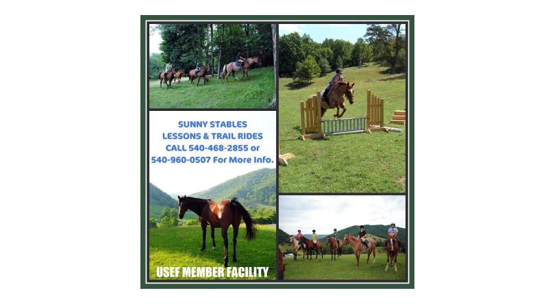
Locality:
Sunny Stables is located in Picturesque Highland County Va. We offer lessons for all ages and riding abilities and specialize in the English Discipline. Instruction is provided on any of our great lesson horses or on your own personal horse. Lessons are taught by a Virginia Intermont College Equine Major with over 20 years of experience. We also offer trail rides for individuals or groups and have 2 yearly summer horse camps for the younger riders. We are a Fully Insured USEF member facility. Located 25 minutes from The Homestead Resort.
634 Jackson River Road
Monterey, VA 24465Telephone:
540-960-0507
- Hot SpringsThe Cascades golf course at The Omni HomesteadShow details
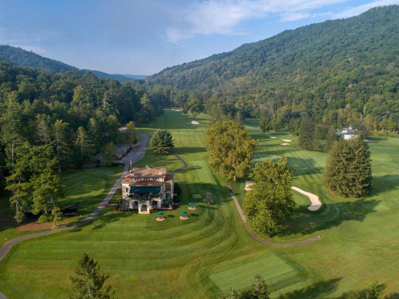
Locality:
Regarded as one of the finest mountain courses in the country, The Cascades offers challenging links set against the backdrop of Virginia's breathtaking Allegheny Mountains. Sam Snead launched his career on this fabled Virginia mountain golf course, which has the honor of being ranked among "America's 100 Greatest Public Golf Courses" by Golf Digest.Designed by legendary course architect William S. Flynn, the Cascades uses its varied terrain to influence play, rather than dictate it. Nationally ranked, The Cascades frequently tops the list of the best Southern courses including Golfweek's #1 course in Virginia.
3789 Sam Snead Highway
Hot Springs, VA 24445Telephone:
540-839-1766
Website:
https://www.omnihotels.com/hotels/homestead-virginia/golf/cascades-course - MontereyTrimble KnobShow details
Locality:
Trimble Knob is a Summit in Highland County. The plug of an ancient volcano, Trimble Knob is the youngest volcano in Virginia. Trimble Knob is visible from US 220. The nearest major town is Mill Gap, VA.
US 220
Monterey, VA 24465Telephone:
540-468-2550
Website:
http://www.highlandcounty.org/ - CovingtonVirginia's Western HighlandsShow details
Locality:
This four-county region is a land of contrasts. It’s home to unspoiled vistas that have barely changed in centuries as well as a world-class resort frequented by celebrities and presidents. Old-fashioned Americana lives on in charming small towns that offer a sophisticated artistic and cultural scene enjoyed by residents and visitors alike. Take your time and wander the many back roads and scenic byways. Discover a favorite picnic spot or a secluded fishing hole. The more you explore, the more you’ll fall in love with Virginia’s Western Highlands.
110 Mall Road
Covington, VA 24426Telephone:
(540) 962-2178
Website:
https://vawesternhighlands.com - MillboroWalton Tract (Cowpasture River)Show details
Locality:
The Walton Tract provides several access points to the Cowpasture River and an excellent opportunity to approach a variety of wildlife. The fields and woodland found along both sides of the river provide a diversity of habitats to explore. The river can also be explored directly from here via the canoe put-in. From Douthat State Park, go north on Rt. 629 to SR 39. Go east on SR 39 for 5.2 miles to SR 42. Travel south on SR 42 for 5.5 miles to Rt. 632. Turn right; head west 1.6 miles to the canoe launch area.
SR 632
Millboro, VA 24460Telephone:
540-839-2521
Website:
http://www.fs.usda.gov/recarea/gwj/recreation/wateractivities/recarea/?recid=74011&actid=79 - New CastleWilderness Adventure at Eagle Landing - Adventure SaturdaysShow details
Locality:
Adventure Saturdays (and longer) at Wilderness Adventure at Eagle LandingAre you looking for something to do with your family? Come join us for a day or weekend of adventure! Ride our World-Famous 900� Zip Line, climb our 50� Climbing Wall, canoe on Craig Creek, bike our trails, try our High Ropes Challenge Course, climb at a real rock climbing site, explore a local cave and more. Bring the whole family. Perfect for families in Roanoke, Blacksburg, Christiansburg, and Salem. Reservations are required...simply send an email or call to plan your family�s adventure.
11176 Peaceful Valley Road
New Castle, VA 24127Telephone:
800-782-0779
- Hot SpringsWinter Sports at The Omni HomesteadShow details
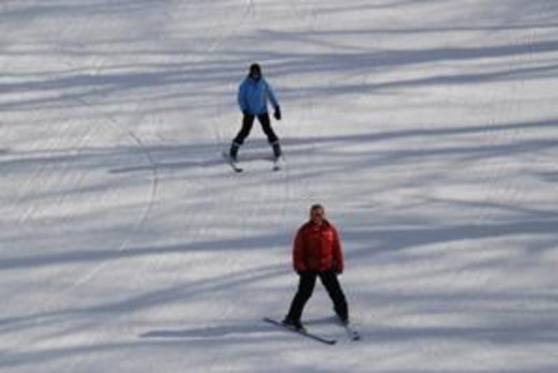
Locality:
Winter, when the Allegheny Mountains are blanketed in white, is the perfect time to embark on snowy getaway to The Omni Homestead Resort. With skiing, snowboarding, tubing, mini snowmobiles, ice skating and a host of other activities, there are lots of ways to enjoy the winter season.The Omni Homestead offers a comfortable, relaxed and uncrowded area ideal for beginners. Home to the Sepp Kober Ski School, The Omni Homestead maintains an experienced team of ski and snowboard instructors who offer private lessons for all levels.Advanced skiers can take to our intermediate trails The Glades, Escape, and Upper Main, while the most seasoned can test their skills on the Nose Dive or The Chute. Kober's at The Mountain Lodge is our signature winter smokehouse designed to reflect Sepp Kober's zest for life with bold BBQ flavors crafted daily. The menu features slow-smoked, freshly-prepared dishes and classic Southern sides. Kober's is an enjoyable experience in a casual, family-friendly environment.Enjoy our spectacular "winter wonderland" at Allegheny Springs. Dip into the steamy waters of our heated, spring-fed outdoor pool or take a spin on the ice skating rink.
The Omni Homestead Resort
7696 Sam Snead Highway
Hot Springs, VA 24445Telephone:
800-838-1766
- Hot SpringsZip ToursShow details

Locality:
The Ridge Runner Zip Tour is an experience with breathtaking views of the surrounding Allegheny Mountains. This adventure spans three hours as you soar through the treetops on eight zip lines then ends at the Mountain Lodge.The Ridge Runner Zip TourAt the top of the ski area, guests will proceed to the first of nine stations which crisscross through the treetops. Our certified guides will lead the group through the series of zip lines while sharing interesting facts about the area. Everyone will find this adventure to be an experience they will never forget.Reservations are required. Closed for the season
7696 Sam Snead Highway
Hot Springs, VA 24445Telephone:
540-839-1766

